

Our products
Asset-level insights: historical data & seasonal forecast
Our products
Site forecast
From 30-year climate insight to monthly operational forecasts
Coordinate-specific insights for precision asset management. Our interface seamlessly integrates 30 years of hourly historical data with a 6-month probabilistic forecast, tailored for the rigorous demands of the energy sector.
What is included in the Standard Interface:
- Hyper-local Accuracy: Wind, Temperature, and Irradiance data for your exact coordinates.
- Operational Horizon: 30 years of climate history merged with a 6-month rolling forecast.
- Energy Yield Focus: Direct Energy Production estimates to align weather data with financial reality.
- Monthly Updates: Automated interface refresh to keep your risk assessments always current.
- Full Data Access: Downloadable 30-year hourly series via API or CSV/Excel reports.
Looking for a longer horizon? For complex asset evaluation and long-term liquidity risk, we offer ad-hoc consultancy projects extending visibility up to 12 or 18 months.
Contact our team to discuss your specific portfolio needs.
Experience the Interface
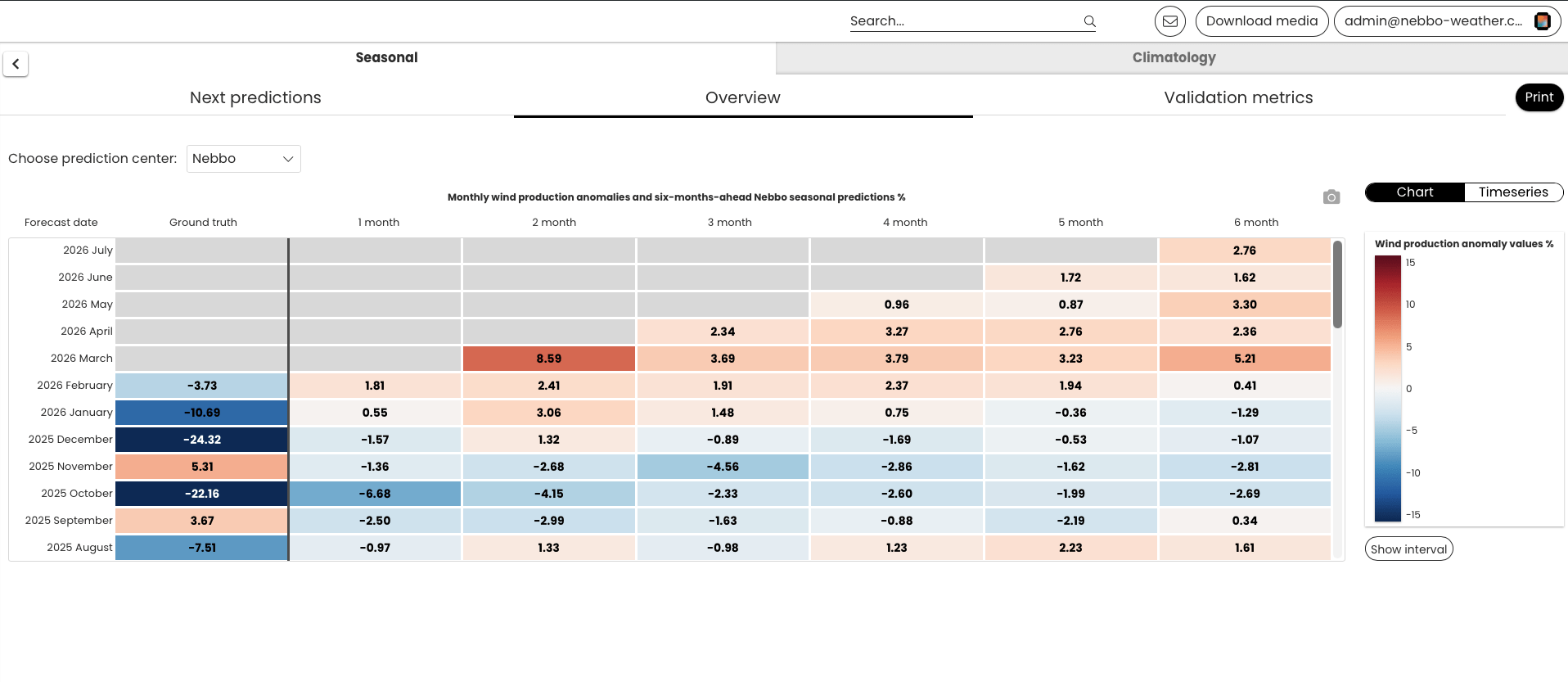
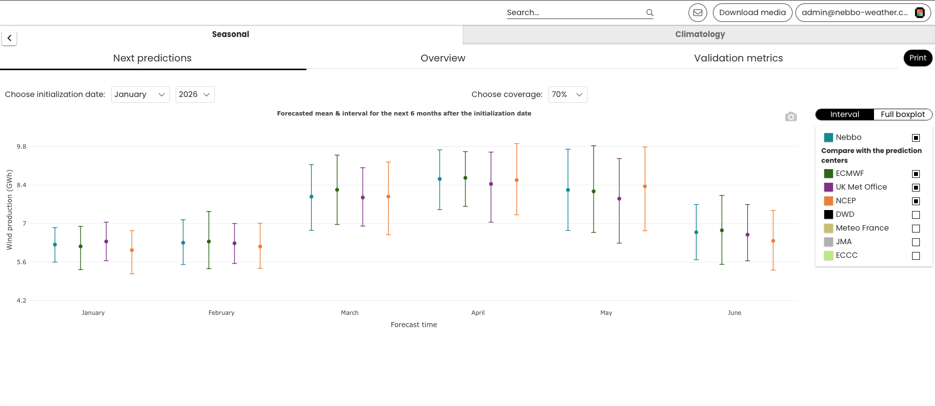
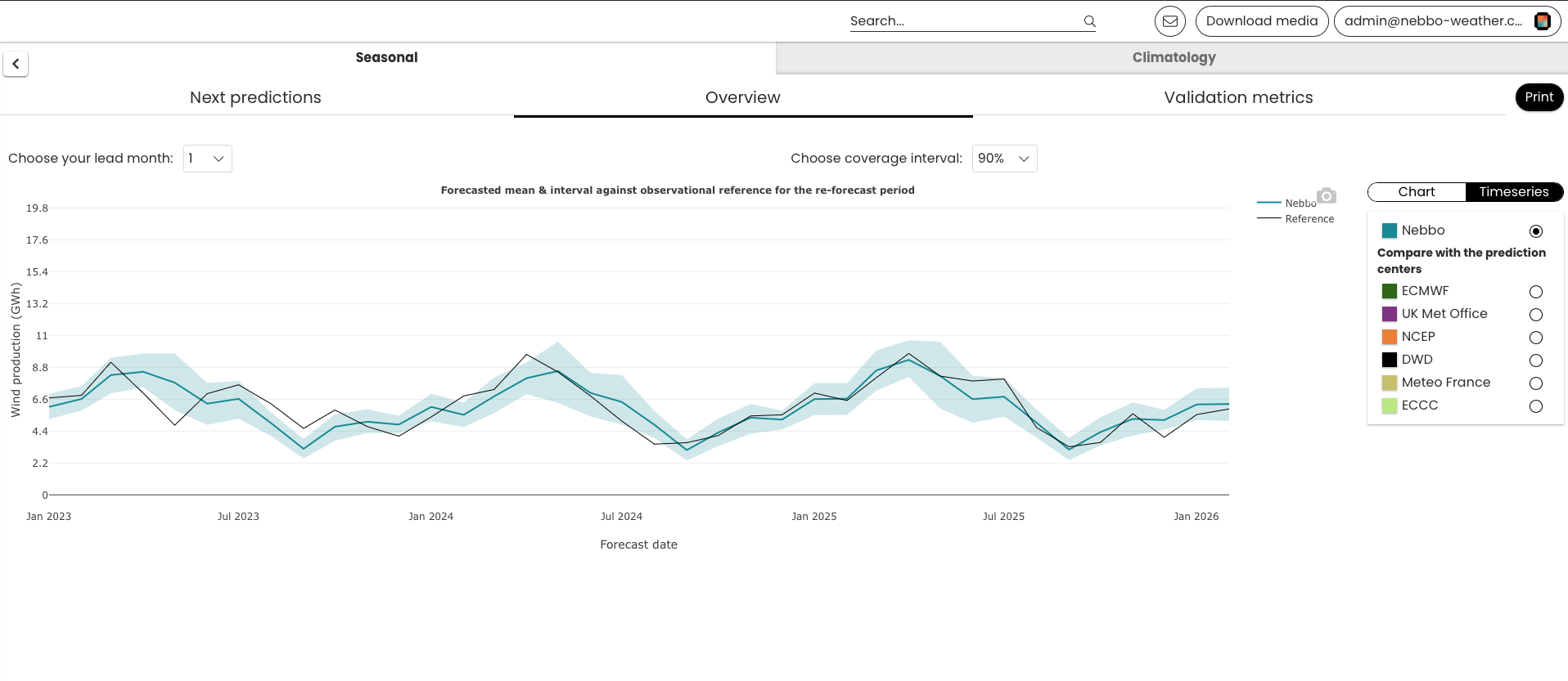
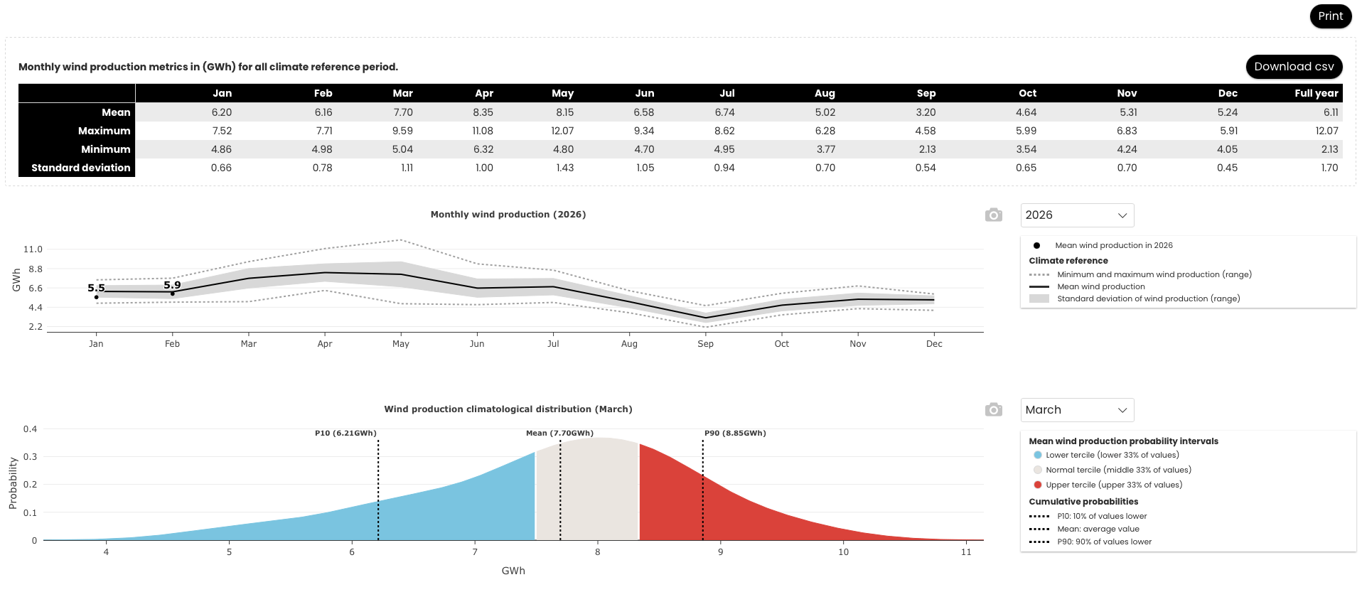
Decision-makers often use climatology as a baseline, that is assuming next month will be analogous to the past years’ months. Although this
climatology benchmark may hold value in certain situations, it lacks insights into future and unseen variability. Our tool was devised precisely to surpass this baseline.
Technical Q&A
1. How is the meteorological data calibrated?
Our calibration process leverages Vortex’s 30-year historical series, which are downscaled to site-specific coordinates using advanced WRF (Weather Research and Forecasting) models. We then apply Machine Learning bias-correction techniques to align global atmospheric signals with local terrain complexities, ensuring that the 6-month forecast is anchored in three decades of climate reality.
2. What is the spatial and temporal resolution of the insights?
We provide coordinate-specific (site-specific) precision. Unlike standard regional forecasts, Nebbo’s interface delivers data tailored to the exact GPS coordinates of your asset.
- Spatial Resolution: Our standard atmospheric variables are modeled at a high-resolution 3 km grid, ensuring local terrain effects are captured.
- Temporal Resolution: The 30-year historical series is provided in hourly steps, while the seasonal interface focuses on monthly probabilistic anomalies.
Need more granularity? For specialized studies, we can explore different temporal granularities (such as daily or sub-hourly data) and custom spatial domains through our ad-hoc consultancy projects.
3. How do you handle uncertainty in the 6-month forecast?
Long-term forecasting is inherently probabilistic. Instead of a single deterministic number, Nebbo provides an ensemble-based outlook. We present various scenarios (P50, P75, P90) to show the range of possible outcomes, allowing risk managers to quantify the likelihood of extreme events or low-resource periods with strategic confidence.